Thời tiết Hà Nội
Thứ 6, ngày 31 tháng 07
30°
Gió: 3 m/s
Lượng mưa: 0 mm
Áp suất: 1000 hPa
Mây u ám. Hiện tại có độ ẩm lý tưởng, thời tiết nóng, cảm giác như là 38°.
Thứ 6
20°
Thứ 7
20°
Chủ nhật
20°
Thứ 2
20°
Thứ 3
20°
Thứ 4
20°
Thứ 5
20°
ĐỊA ĐIỂM PHỔ BIẾN
VAI TRÒ CỦA THỜI TIẾT
Thời tiết là một yếu tố tác động mạnh mẽ đến cuộc sống của chúng ta. Khí hậu Việt Nam biến động thất thường, thay đổi liên tục theo mùa. Vì thế, chắc chắn không thể xem nhẹ vai trò của dự báo thời tiết. JcWeather cam kết là người bạn đồng hành, đối tác đáng tin cậy của tất cả khách hàng.

KHÔNG DỰ ĐOÁN THỜI TIẾT
CHÚNG TÔI GIÁM SÁT THỜI TIẾT!
Thu thập, đo đạc và nghiên cứu các nguồn dữ liệu uy tín, JcWeather cập nhật dữ liệu dự báo thời tiết chính xác nhất. Tỷ lệ thông tin chính xác của chúng tôi luôn nằm trên ngưỡng 90%.
-
Cập Nhật Vị Trí Chính Xác
Chúng tôi hỗ trợ tính năng tự động cập nhật vị trí chính xác. Hãy cho phép website thu thập dữ liệu tọa độ hiện tại trên trình duyệt của bạn
-
Dự Báo Thời Tiết Chi Tiết
Thông tin thời tiết với đầy đủ chỉ số: Kiểu thời tiết, Nhiệt độ, Độ ẩm, Tốc độ gió, Tầm nhìn, Áp suất, Chất lượng không khí, v.v.
-
Thời Tiết 63 Tỉnh Thành
Dữ liệu thời tiết chính xác của hơn 11.000 đơn vị hành chính tại Việt Nam, từ Tỉnh Thành, Quận Huyện cho đến Phường Xã.
-
Thiết Kế Tối Ưu
Thiết kế tối giản, trải nghiệm mượt mà, đầy đủ tình năng và tiện ích. JcWeather đảm bảo mang đến sự hài lòng cao nhất cho người dùng.
Tin tức thịnh hành
Xem tất cả-

VJOL Info là tạp chí khoa học, văn học tốt nhất 2026
20 Tháng 01, 2026
Đọc thêm
-

Tổng hợp những bài hát về mùa xuân hay, ý nghĩa & rộn ràng cho dịp Tết thêm vui tươi
10 Tháng 03, 2025
Đọc thêm
-
Danh sách những bài hát về mùa thu hay nhất (Nghe thử là nghiền ngay)
10 Tháng 03, 2025
Đọc thêm
-
Top những bài hát về mùa hè hay và ý nghĩa được nghe nhiều nhất 2025
10 Tháng 03, 2025
Đọc thêm
-
Tổng hợp những bài hát về mùa đông hay nhất (Ca khúc vào đông lạnh lẽo, buồn sâu lắng)
10 Tháng 03, 2025
Đọc thêm
-

Sapa có tuyết không? Dấu hiệu và thời điểm dễ “săn” tuyết rơi nhất tại Sapa
05 Tháng 02, 2025
Đọc thêm
-

Các loại cây nhiệt đới nổi tiếng tại Việt Nam (Có hình ảnh minh họa)
02 Tháng 10, 2024
Đọc thêm
-
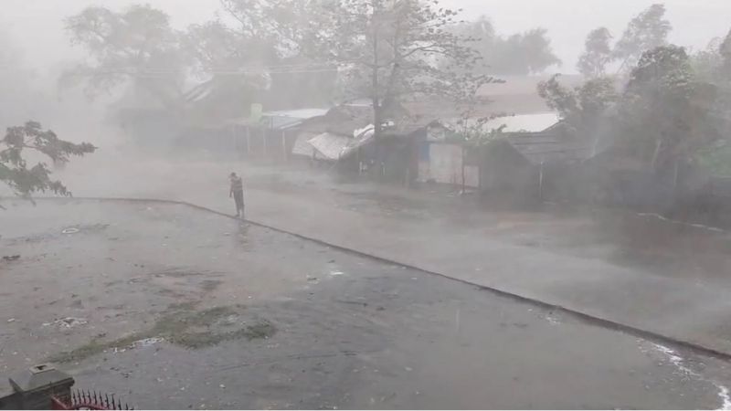
Tổng hợp các cơn bão lớn thế giới trong lịch sử (#6 Siêu bão có sức tàn phá khủng khiếp)
02 Tháng 10, 2024
Đọc thêm
-

TOP 5 rừng nhiệt đới ở Việt Nam đa dạng sinh học nhất
02 Tháng 10, 2024
Đọc thêm
-
Những loài có nguy cơ tuyệt chủng ở Việt Nam cần được bảo vệ
23 Tháng 09, 2024
Đọc thêm
-

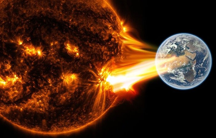
Bão mặt trời là gì? Lý giải nguyên nhân hình thành và các tác hại của bão từ đối với Trái đất
23 Tháng 09, 2024
Đọc thêm
-

Thủy triều đen là gì? #6 nguyên nhân dẫn đến tràn dầu trên biển
23 Tháng 09, 2024
Đọc thêm