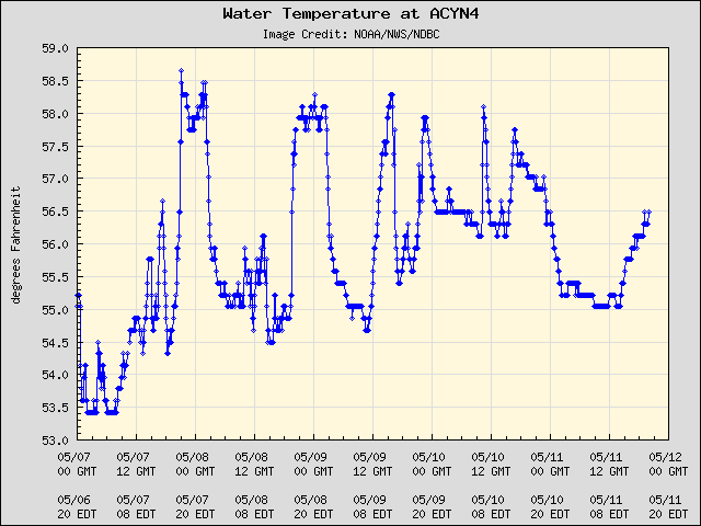
Station Code: ACYN4 - Location: 39.355 N 74.418 W (39°21'18" N 74°25'6" W)

Station Code: CMAN4 - Location: 38.968 N 74.960 W (38°58'6" N 74°57'36" W)


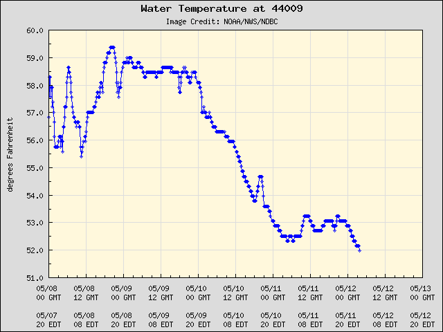
Station Code: 44009 - Location: 38.464 N 74.702 W (38°27'49" N 74°42'7" W)

Station Code: 8555889 - Location: 38.987 N 75.113 W (38°59'13" N 75°6'47" W)
Station Code: 8537121 - Location: 39.305 N 75.377 W (39°18'19" N 75°22'36" W)
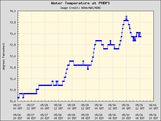
Station Code: PHBP1 - Location: 39.933 N 75.142 W (39°56'0" N 75°8'30" W)